Lake Ontario, the smallest and easternmost of the Great Lakes of North America, forms part of the border between the United States (New York) and Canada (Ontario). Known for its deep waters, scenic shorelines, and historical significance, Lake Ontario plays a vital role in commerce, shipping, and recreation. From the bustling port of Toronto to the Niagara River connecting it to Lake Erie, this lake is a hub of natural beauty and economic activity. Whether you’re exploring its fishing spots, lighthouses, or historic shipwrecks, Lake Ontario is an essential destination for travelers and nature enthusiasts alike.
Table of Contents
Location of Lake Ontario: Country, States, Cities
Lake Ontario is one of the five Great Lakes of North America (Superior, Michigan, Huron, Erie), located on the border between the United States and Canada. It is situated between the province of Ontario in Canada to the north and the state of New York in the United States to the south.
| Category | Details |
|---|---|
| Countries Bordering Lake Ontario | United States, Canada |
| U.S. State Bordering Lake Ontario | New York |
| Canadian Province Bordering Lake Ontario | Ontario |
| Major U.S. Cities on Lake Ontario | Rochester, Oswego, Niagara-on-the-Lake (near Niagara River outlet) |
| Major Canadian Cities on Lake Ontario | Toronto, Hamilton, Oshawa, Kingston |
Major Cities on Lake Ontario
Hamilton, Kingston, Mississauga, and Toronto are Canadian cities situated along the northern shorelines of Lake Ontario, while the American city of Rochester (New York) is located on the lake’s southern shore.

Major Cities on the U.S. Side of Lake Ontario
Lake Ontario’s U.S. shoreline is entirely within New York State, with the primary cities serving as industrial, residential, and economic hubs along the southern coast.
| City | Description / Significance |
|---|---|
| Rochester, NY | Located on the Genesee River near Lake Ontario; largest U.S. city directly on the lake’s shore, with major industrial and cultural significance. |
| Watertown, NY | Situated near the eastern end of the lake, close to the St. Lawrence River; a key hub for Jefferson County and surrounding areas. |
Major Cities on the Canadian Side of Lake Ontario
The Canadian shoreline of Lake Ontario is part of Ontario Province, with major urban centers forming the densely populated Golden Horseshoe region. These cities are key hubs for industry, trade, population, and tourism.
| City | Description / Significance |
|---|---|
| Toronto | Largest city in Canada, on the northwestern shore; major economic and cultural center. |
| Mississauga | Adjacent to Toronto, with a large population and significant industrial presence. |
| Hamilton | Prominent port city on the western tip of the lake; known for its industrial sector. |
| St. Catharines | Located in the Niagara Region on the southern shore; often called the “Garden City.” |
| Kingston | Eastern end of the lake; famous for historic sites and as a gateway to the Thousand Islands. |
| Oshawa | East of Toronto; part of the Greater Toronto Area’s eastern edge, with industrial and residential significance. |
| Burlington | Between Hamilton and Mississauga; western shore city with residential and commercial importance. |
Size of Lake Ontario: Surface Area, Volume, Length, Width, Shoreline, Depth
| Feature | Details |
|---|---|
| Surface Area | ~7,300–7,340 sq mi (18,960–19,009 km²) |
| Volume | ~391–395 cu mi (1,631–1,639 km³) |
| Length | 193 miles (311 km) |
| Width | 53 miles (85 km) |
| Maximum Depth | 802 ft (244 m) |
| Mean Depth | 283 ft (86 m) |
| Shoreline (including islands) | 726 miles (1,161 km) |
| Bordering Regions | North: Ontario, Canada; South: New York, USA |
| Outflow | St. Lawrence River (lowest-elevation link in the Great Lakes chain) |
Surface Area of Lake Ontario
Lake Ontario has a surface area of about 7,340 square miles (18,960 square kilometers), making it the smallest of the Great Lakes by surface area.
Volume of Lake Ontario
Lake Ontario has a volume of about 393 cubic miles (1,640 cubic kilometers), ranking it fourth among the Great Lakes in terms of volume.
Maximum Length and Width of Lake Ontario
The lake stretches about 193 miles (311 km) in length from west to east, with a maximum width of 53 miles (85 km), giving it an elongated shape that defines the southern border of Ontario and the northern coast of New York.
Shoreline Length of Lake Ontario
The lake has a shoreline of 726 miles (1,161 km), including numerous islands and coastal communities, providing scenic views, recreational areas, and habitats for wildlife.
Depth of Lake Ontario
It is the second-deepest of the Great Lakes, with a maximum depth of approximately 802 feet (244 meters) and average depth of 283 feet (86 meters).
Formation and History of Lake Ontario
Lake Ontario was formed approximately 11,000–12,000 years ago during the retreat of the massive Laurentide Ice Sheet, which once covered the region with ice over two kilometers thick. As the glaciers melted, they carved out the basin that would become the lake, leaving behind meltwater that initially formed glacial Lake Iroquois, a larger predecessor to Lake Ontario. Over the next 4,000–10,000 years, the lake gradually assumed its modern shape and water level, becoming the smallest of the Great Lakes by surface area but notably deep at 802 feet (244 meters).
Geological Formation
- Glacial Origins: The last Ice Age glaciers sculpted the lake basin, gouging deep channels and creating the contours of the modern lake.
- Post-Glacial Evolution: Retreating ice left behind meltwater that initially formed a larger lake, Lake Iroquois.
- Modern Structure: Over thousands of years, sediment deposition and water drainage shaped the lake into its current dimensions: approximately 7,323 sq mi (18,970 km²) in area.
Indigenous Connection
The name “Ontario” comes from the Huron word Ontarí’io, meaning “great lake” or “beautiful water.” For over 10,000 years, Indigenous communities lived along the shores, relying on the lake for fishing, transportation, and cultural practices while practicing sustainable stewardship of its waters.
Trade and Military Significance
Lake Ontario has long been a vital transportation corridor, connecting the Great Lakes to the St. Lawrence River and the Atlantic Ocean. It played a significant role in trade, settlement, and military history, including key engagements during the War of 1812.
Modern Role and Environmental Changes
Today, Lake Ontario is essential for drinking water, commerce, and recreation, serving more than 9 million people along the Toronto-Hamilton-Rochester corridor. The lake has experienced ecological shifts over the past six decades, including changes in water quality and aquatic communities. Industrialization in the 20th century contributed to environmental degradation, but ongoing restoration efforts, such as salmon reintroduction programs, aim to maintain the lake’s health and biodiversity.
Major Rivers Feeding Lake Ontario
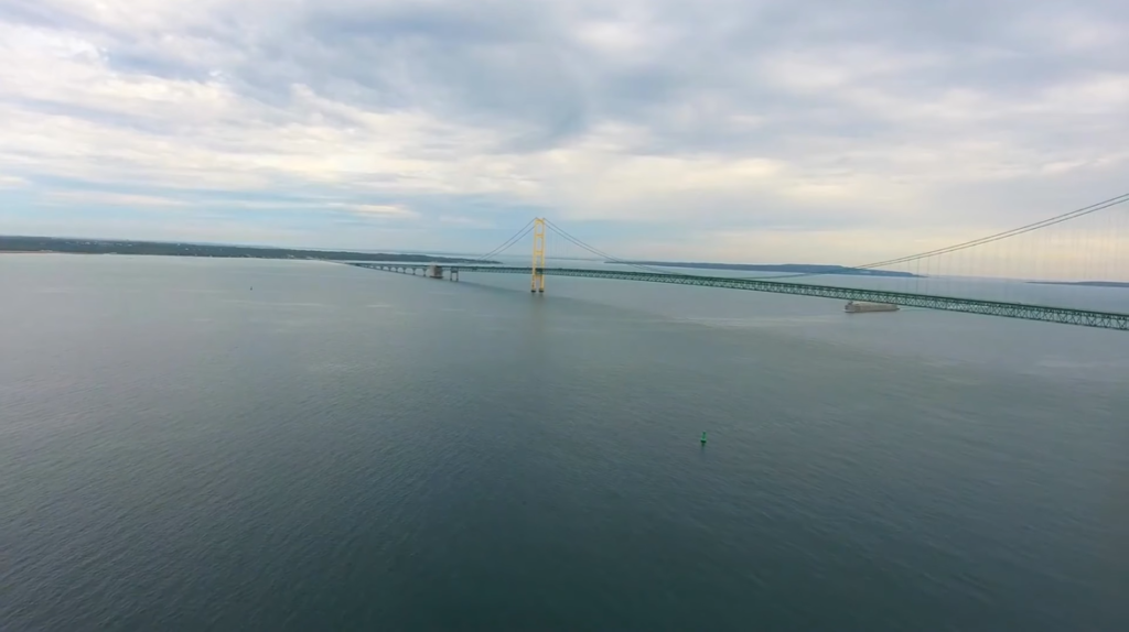
Lake Ontario receives water from several important rivers, with the Niagara River serving as the primary source. Draining Lake Erie, the Niagara River contributes approximately 80% of Lake Ontario’s total inflow, making it the most significant tributary in the Great Lakes system.
Major U.S. Rivers Feeding Lake Ontario
| River | Location / Notes |
|---|---|
| Niagara River | Primary inflow, drains Lake Erie, ~80% of total inflow |
| Oswego River | Eastern New York, major tributary |
| Genesee River | Near Rochester, NY; significant for ecology and water supply |
| Salmon River | New York; known for trout and salmon runs |
| Black River | Eastern end of Lake Ontario |
Major Canadian Rivers Feeding Lake Ontario
| River | Location / Notes |
|---|---|
| Trent River | Part of Trent-Severn Waterway, central Ontario |
| Humber River | Flows through Toronto, urban waterway |
| Don River | Flows through Toronto, important for urban ecosystem |
| Cataraqui River | Near Kingston, Ontario; connects local watersheds |
Lake Ontario Outflow
| Outlet | Description |
|---|---|
| St. Lawrence River | Primary outflow, carries water from Lake Ontario to the Atlantic Ocean |
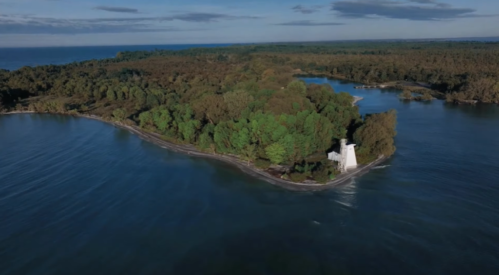
Islands in Lake Ontario
Lake Ontario is home to roughly 100 islands, most of which are concentrated along its eastern shore near Kingston and the St. Lawrence River, with additional clusters near Prince Edward County and Toronto. These islands vary from inhabited communities to remote wildlife refuges, offering scenic views, recreational opportunities, and historical significance. Notable islands include Wolfe Island, Amherst Island, and the Toronto Islands, while smaller U.S. islands such as Galloo Island provide important habitats for birds and other wildlife. The lake’s islands and archipelagos are a mix of rural landscapes, recreational areas, and cultural landmarks, making them an integral part of the Lake Ontario experience.
Major Islands on the Canadian Side of Lake Ontario
| Island | Location / Notes |
|---|---|
| Wolfe Island | Largest island near Kingston/Cape Vincent; rural landscape, wind turbines, part of the Thousand Islands region |
| Amherst Island | Near Bath, Ontario; rural, known for birdwatching and historic limestone buildings |
| Toronto Islands | Chain of 15 small, car-free islands off downtown Toronto; beaches, amusement areas, city skyline views |
| Howe Island | Entrance to the St. Lawrence River; rural and residential atmosphere |
| Main Duck Island | Remote eastern basin island in Canada |
Major Islands on the U.S. Side of Lake Ontario
| Island | Location / Notes |
|---|---|
| Galloo Island | Rural, largely uninhabited; bird refuge |
| Little Galloo Island | Smaller island near Galloo; bird habitat |
| Association Island | Near Henderson Harbor, NY; rural/residential |
Key Archipelagos / Areas
| Area | Description |
|---|---|
| Thousand Islands | Primarily in the St. Lawrence River, begins at northeastern Lake Ontario near Kingston |
| Bay of Quinte Islands | Several smaller islands within the sheltered Bay of Quinte, Prince Edward County |
Temperature of Lake Ontario
Lake Ontario experiences significant seasonal temperature variations, with surface waters ranging from near-freezing in the winter to warm summer conditions. The average annual surface temperature is approximately 10.3°C (50.5°F).
Seasonal Temperature Pattern of Lake Ontario
| Season | Surface Temperature | Notes |
|---|---|---|
| Winter (Feb) | Mid-30s°F (1–3°C) | Icy conditions along the shoreline; limited recreation |
| Spring (Mar–May) | 40–55°F (4–13°C) | Gradually warming; snowmelt and runoff influence water levels |
| Summer (Jun–Aug) | 65–75°F (18.8–24.5°C) | Optimal swimming late July–early September; peak recreational activity |
| Autumn (Sep–Nov) | 50–65°F (10–18°C) | Cooling waters; migration season for fish and birds |
Month-Wise Surface Temperature of Lake Ontario
| Month | Average Surface Temperature | Notes / Conditions |
|---|---|---|
| January | 33–35°F (0.5–1.5°C) | Coldest month; icy patches along the shore |
| February | 34–36°F (1–2°C) | Peak winter; limited water activity |
| March | 36–42°F (2–5°C) | Gradual warming; ice melts along shoreline |
| April | 42–50°F (6–10°C) | Spring warming; runoff from melting snow increases lake levels |
| May | 50–58°F (10–14°C) | Water still cool; early recreational activities begin |
| June | 58–65°F (14–18°C) | Comfortable for boating; fish activity increases |
| July | 65–72°F (18–22°C) | Peak summer; ideal swimming season starts |
| August | 68–75°F (20–24°C) | Warmest month; high recreational usage |
| September | 63–70°F (17–21°C) | Swimming season ends; water gradually cools |
| October | 53–57°F (12–14°C) | Cooler waters; seasonal fish migration |
| November | 45–50°F (7–10°C) | Early winter; ice may begin forming near the shore |
| December | 35–40°F (2–4°C) | Winter returns; icy conditions common |
Wildlife in Lake Ontario
Lake Ontario supports a diverse ecosystem of both aquatic and terrestrial species. Its waters, shoreline, and surrounding habitats create ideal conditions for fish, mammals, birds, reptiles, amphibians, and invertebrates, making the lake a hotspot for biodiversity and recreational activities like fishing and birdwatching.
Animals in Lake Ontario
| Category | Species / Examples |
|---|---|
| Mammals | American beaver, muskrat, river otter, mink, fisher, white-tailed deer |
| Birds | Bald eagle, osprey, common loon, ring-billed gull, mute swan, double-crested cormorant, red-breasted merganser |
| Reptiles & Amphibians | Snapping turtle, other turtles, frogs, salamanders |
| Invertebrates | Mites, beetles, flies, wolf spiders, other arthropods |
Fish Found in Lake Ontario
| Type | Species / Notes |
|---|---|
| Salmon | Chinook, Coho |
| Trout | Rainbow trout, lake trout |
| Bass | Smallmouth bass, largemouth bass |
| Other Game Fish | Walleye, muskellunge, northern pike, yellow perch, freshwater drum |
| Non-native / Key Species | Alewife (important in the food web) |
Biggest Fish in Lake Ontario
| Species | Typical Size / Notes |
|---|---|
| Lake sturgeon | Up to 7–9 ft (2–2.7 m), over 300 lbs (136 kg); slow-growing, long-lived |
| Muskellunge (Muskie) | Up to 6 ft (1.8 m), 60–70 lbs (27–32 kg) |
| Northern pike | Up to 4 ft (1.2 m), 30–40 lbs (14–18 kg) |
| Lake trout | Up to 4.5 ft (1.4 m), 50–60 lbs (23–27 kg) |
| Chinook Salmon | Up to 4 ft (1.2 m), 40–50 lbs (18–23 kg) |
Aquatic Plants in Lake Ontario
| Type | Examples / Notes |
|---|---|
| Submerged Plants | Eurasian watermilfoil, pondweeds (Potamogeton spp.), coontail |
| Floating Plants | Duckweed, water lilies |
| Emergent / Shoreline Plants | Cattails, bulrushes, sedges, reeds |
| Invasive Species | Hydrilla, purple loosestrife, Phragmites australis (common reed) |
| Ecological Role | Provide habitat for fish and invertebrates, stabilize shoreline, contribute to oxygen production |
Famous Ships Sunk in Lake Ontario
Lake Ontario is known for its cold, deep waters, which have preserved many historic shipwrecks over the centuries. From War of 1812 vessels to commercial freighters, these wrecks tell stories of storms, battles, and maritime history across the lake. The table below highlights the most famous shipwrecks and their locations.
| Ship / Wreck | Year | Details / Notes |
|---|---|---|
| HMS Ontario | 1780 | Oldest, most intact British warship in the Great Lakes; sank in a gale with 120+ onboard; discovered 2008 |
| USS Hamilton & USS Scourge | 1813 | American warships lost during War of 1812 storm; upright and well-preserved at 88 m depth |
| Washington (Lady Washington) | 1803 | Oldest commercial sailing vessel in the Great Lakes; discovered 2016 off southern shore |
| Nisbet Grammer | 1926 | 261-ft steel freighter; sank in 15 minutes after collision in fog; discovered 2014 |
| HMS Speedy | 1804 | Schooner that vanished near Presqu’ile |
| St. Peter | 1898 | 3-masted schooner; sank during a storm |
Importance of Lake Ontario
Lake Ontario is one of the most valuable freshwater resources in North America, serving millions of people across the United States and Canada. Its ecological, economic, and cultural significance makes it a critical part of the Great Lakes system.
| Aspect | Details / Significance |
|---|---|
| Ecological Significance | Part of the largest freshwater system; supports over 2,000 islands, alvar habitats, wetlands, marshes, and diverse wildlife including salmon and trout |
| Economic Hub | Vital shipping corridor to the Atlantic, supports tourism, recreation, and sport-fishing industry; drives regional economy in cities like Toronto, Mississauga, and Rochester |
| Water Supply | Primary source of fresh water for millions of residents, agriculture, and industrial processes |
| Historical & Cultural Value | Major trade route; significant in the War of 1812; shoreline inhabited by Indigenous peoples for thousands of years |
| Climate Regulation | Influences regional weather and climate, moderating temperatures along the shorelines |
| Scientific Importance | Provides opportunities for research and environmental monitoring, studying human impacts and ecosystem health |
Scary Facts About Lake Ontario
Beneath its scenic surface, Lake Ontario hides a dark and dangerous reality. With depths exceeding 800 feet, well-preserved shipwrecks, unpredictable storms, industrial pollution, and local legends like the “Lake Ontario Serpent”, the lake has inspired awe and caution for centuries. From ecological threats to historical mysteries, here are the most terrifying aspects of Lake Ontario:
| Scary Aspect | Details / Notes |
|---|---|
| Deep Underwater Graveyards | Numerous shipwrecks over 200+ years are preserved in cold, deep freshwater, sometimes still containing remains of crews |
| The “Lake Ontario Serpent” | Local legends report sightings of a large, serpent-like creature lurking in deep waters |
| Industrial Pollutant Trap | Receives toxic runoff from upstream industrial areas, including the Niagara River, impacting the ecosystem |
| Immense Depths | Smallest Great Lake by surface area but reaches over 800 feet, especially in the Rochester Basin; dangerous for boats and swimmers |
| Sudden, Intense Storms | Rapidly forming storms produce massive waves and unpredictable conditions for sailors |
| Invasive Species Overload | Sea Lamprey, mussels, and other invasive species have disrupted native habitats |
| Massive Prehistoric Fish | Lake Sturgeon, a “living fossil,” can grow over 2 meters long and weigh ~180 kg |
Quick Facts About Lake Ontario
| Category | Details / Examples |
|---|---|
| Location | Border of New York, USA (south) and Ontario, Canada (north) |
| Countries | United States, Canada |
| U.S. States | New York |
| Canadian Province | Ontario |
| Major U.S. Cities | Rochester, Watertown |
| Major Canadian Cities | Toronto, Mississauga, Hamilton, St. Catharines, Kingston, Oshawa, Burlington |
| Surface Area | ~7,300–7,340 sq mi (18,960–19,009 km²) |
| Volume | ~391–395 cu mi (1,631–1,639 km³) |
| Length | 193 miles (311 km) |
| Width | 53 miles (85 km) |
| Maximum Depth | 802 ft (244 m) |
| Mean Depth | 283 ft (86 m) |
| Shoreline | 726 miles (1,161 km) |
| Primary Inflow | Niagara River (~80% of total inflow) |
| Other Tributaries | Oswego River, Genesee River, Salmon River, Black River (U.S.); Trent River, Humber River, Don River, Cataraqui River (Canada) |
| Primary Outflow | St. Lawrence River |
| Major Islands | Wolfe Island, Amherst Island, Howe Island, Toronto Islands, Galloo & Little Galloo Islands, Main Duck Island, Big Island, Waupoos Island, Association Island |
| Wildlife | Fish: salmon, trout, walleye, bass, lake sturgeon; Mammals: beaver, muskrat, river otter, white-tailed deer; Birds: bald eagle, osprey, loons; Reptiles & Amphibians: turtles, frogs; Invertebrates: beetles, flies, spiders |
| Biggest Fish | Lake sturgeon (7–9 ft, 300+ lbs), Muskellunge (6 ft, 60–70 lbs), Northern pike, Lake trout, Chinook salmon |
| Aquatic Plants | Submerged: Eurasian watermilfoil, pondweeds; Floating: duckweed, water lilies; Emergent: cattails, bulrushes; Invasive: hydrilla, purple loosestrife |
| Surface Temperature | Jan–Feb: 33–36°F (0.5–2°C); Summer: 65–75°F (18–24°C); Annual Avg: 50.5°F (10.3°C) |
| Famous Shipwrecks | HMS Ontario (1780), USS Hamilton & USS Scourge (1813), Washington (1803), Nisbet Grammer (1926), HMS Speedy (1804), St. Peter (1898) |
| Scary Facts | Depths >800 ft, preserved wrecks, sudden storms, industrial pollution, invasive species, “Lake Ontario Serpent”, massive prehistoric fish (sturgeon) |
| Importance | Ecological: diverse habitats, wildlife; Economic: shipping, tourism, fishing; Water Supply: drinking, agriculture, industry; Historical & Cultural: trade route, War of 1812; Climate Regulation: moderates regional weather; Scientific: research and environmental monitoring |
Frequently Asked Questions About Lake Ontario
Q. Where is Lake Ontario?/What state borders Lake Ontario?/Is Lake Ontario in US or Canada?
A. Lake Ontario lies on the border between Canada (Ontario) and the United States (New York).
Q. Which U.S. state has a shoreline on Lake Ontario?/What is the only U.S. state to border Lake Ontario?
A. The only U.S. state that has a shoreline on Lake Ontario is New York.
Q. What cities are on Lake Ontario?
A. Major cities along Lake Ontario include Toronto (Canada), Hamilton (Canada), Kingston (Canada), Rochester (USA), and Oswego (USA).
Q. How big is Lake Ontario?
A. Lake Ontario is the smallest Great Lake by surface area (7,340 square miles) but one of the deeper lakes, reaching depths of about 802 feet.
Q. How long is Lake Ontario?
A. Lake Ontario is approximately 193 miles (311 kilometers) long.
Q. How wide is Lake Ontario?
A. Lake Ontario maximum width is approximately 53 miles (85 kilometers).
Q. How deep is Lake Ontario?/What is the average depth of Lake Ontario?/How deep is Lake Ontario in feet?
A. Lake Ontario reaches a maximum depth of about 802 feet, with an average depth of roughly 283 feet.
Q. How deep is Lake Ontario at its deepest point?
A. The deepest point in Lake Ontario is approximately 802 feet (244 meters). This deepest part is located near the eastern end of the lake, off the northern shore, not far from the city of Rochester, New York. This depth makes Lake Ontario the fourth-deepest among the Great Lakes.
Q. How many gallons of water in Lake Ontario?
A. Lake Ontario contains approximately 1.6 trillion gallons of water.
Q. How do ships get from Lake Erie to Lake Ontario?
A. Ships travel from Lake Erie to Lake Ontario via the Welland Canal, which bypasses Niagara Falls.
Q. Is Lake Ontario man made?
A. No, Lake Ontario is a natural lake, not man-made.
Q. Is Lake Ontario connected to the ocean?
A. Yes, Lake Ontario is connected to the Atlantic Ocean via the St. Lawrence River and the St. Lawrence Seaway, allowing ships to travel between the ocean and the Great Lakes.