Lake Lanier, officially known as Lake Sidney Lanier, is a large freshwater reservoir located in northern Georgia, United States. Renowned for its scenic beauty and recreational appeal, the lake covers a vast area and plays a vital role in water supply, tourism, and outdoor recreation in the region. Created in the mid-20th century, Lake Lanier has a rich history tied to the construction of Buford Dam and the transformation of the Chattahoochee River basin.
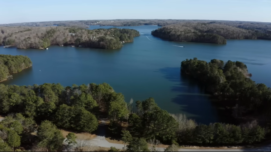
Today, the lake is famous for its recreational activities, including boating, fishing, swimming, camping, and water sports, attracting millions of visitors each year. Lake Lanier features numerous small islands, diverse wildlife, and seasonal water temperature changes that influence both recreation and aquatic life. With its impressive size, strategic location, and fascinating natural and human-made features, Lake Lanier remains one of Georgia’s most important and popular lakes, offering a mix of history, nature, and unforgettable lake experiences.
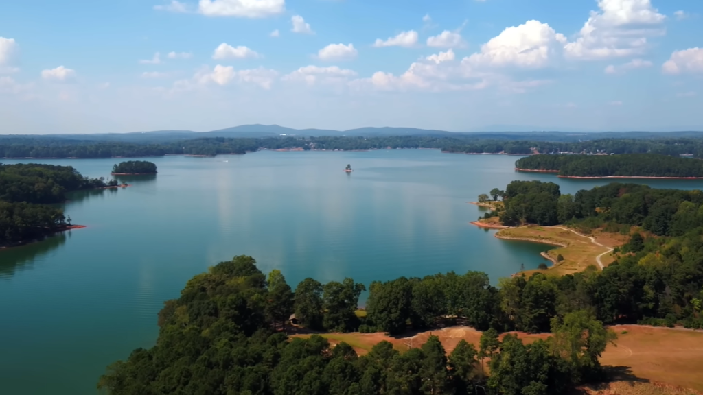
Table of Contents
Location of Lake Lanier: Country, States, Cities
Lake Lanier is a man-made reservoir located in North Georgia, United States, approximately 50 miles (80 km) northeast of Atlanta. The lake lies in the foothills of the Blue Ridge Mountains and was created in 1956 by the U.S. Army Corps of Engineers following the construction of Buford Dam on the Chattahoochee River.
Lake Lanier spans five counties—primarily Hall County, along with Forsyth, Dawson, Gwinnett, and Lumpkin counties—and is surrounded by several major cities and growing communities. Gainesville, Georgia, is the most prominent city on the lake, serving as a key access point and regional hub. Other nearby towns include Cumming, Buford, Flowery Branch, and Oakwood, all of which contribute to the lake’s popularity for recreation, tourism, and residential development.
| Detail | Information |
|---|---|
| Type | Man-made reservoir |
| Country | United States |
| State | Georgia |
| Region | North Georgia |
| Distance from Atlanta | About 50 miles (80 km) northeast |
| Counties Covered | Hall (60%), Forsyth (30%), Dawson (5%), Gwinnett (4%), Lumpkin (1%) |
| Nearby Cities & Towns | Gainesville, Cumming, Buford, Flowery Branch, Oakwood |
| Major City on the Lake | Gainesville, Georgia |
Size of Lake Lanier: Surface Area, Volume, Length, Width, Depth Shoreline
Lake Lanier is one of the largest man-made reservoirs in the southeastern United States. The lake’s size plays a major role in its importance as a water supply source, recreational hub, and ecological system. From its expansive surface area to its deep waters near Buford Dam, Lake Lanier’s dimensions make it both impressive and functional.
| Size Feature | Details |
|---|---|
| Surface Area | Approximately 38,000–39,000 acres (about 59 square miles) at full pool |
| Water Volume | Roughly 1.05 million acre-feet (about 637 billion gallons) |
| Length | Approximately 26–27 miles |
| Width | Varies due to coves and arms; up to about 2 miles in wider sections |
| Depth | Maximum depth over 156–160 feet near Buford Dam (up to 200 feet in some areas); average depth around 60 feet |
| Shoreline Length | Approximately 692 miles |
Surface Area of Lake Lanier
At full pool elevation (1,071 feet above mean sea level), Lake Lanier covers approximately 38,000 to 39,000 acres, which is about 59 square miles. This large surface area allows the lake to support heavy recreational use while also storing vast amounts of water for regional needs.
Volume of Lake Lanier
Lake Lanier holds roughly 1.05 million acre-feet of water, equivalent to about 637 billion gallons. This enormous volume makes the lake a critical water source for the Atlanta metropolitan area, especially during dry periods and population growth.
Length of Lake Lanier
The lake stretches approximately 26 to 27 miles from its upper reaches down to Buford Dam. Its length is extended by the winding channels of the Chattahoochee and Chestatee rivers, giving the lake its long, branching shape.
Width of Lake Lanier
Lake Lanier does not have a uniform width. Due to its many coves, arms, and inlets, the lake’s width varies significantly. In wider sections, it can span up to about 2 miles, while narrower arms extend deep into surrounding valleys.
Depth of Lake Lanier
Lake Lanier reaches depths of over 156 to 160 feet near Buford Dam, with some reports suggesting depths approaching 200 feet in certain areas. Across the lake, the average depth is approximately 60 feet.
Shoreline Length of Lake Lanier
One of Lake Lanier’s most notable size features is its extremely long shoreline. The lake has an estimated 692 miles of shoreline, created by its irregular shape and numerous coves. This extensive shoreline provides abundant space for marinas, parks, residential development, and wildlife habitat.
Formation and History of Lake Lanier
Lake Lanier is a 38,000-acre man-made reservoir located in North Georgia, created by the U.S. Army Corps of Engineers through the construction of Buford Dam on the Chattahoochee River. The project was initiated to control flooding along the river, generate hydroelectric power, and provide a reliable water supply for the rapidly growing Atlanta metropolitan area. Planning and land acquisition for the reservoir began in 1948, with construction officially starting in 1950.
The construction of Buford Dam marked the beginning of a major transformation of the region. On February 1, 1956, the dam’s gates were closed, allowing water to begin filling the reservoir. The lake continued to rise over the following years and reached its designated full pool level of 1,071 feet above mean sea level by 1958. In addition to the main dam, the project included the construction of three saddle dikes, which were necessary to contain the expanding reservoir across the surrounding valleys.
The formation of Lake Lanier required the clearing of more than 50,000 acres of land, leading to the displacement of over 250 families, 15 businesses, and approximately 20 cemeteries. Farms, churches, and entire communities were removed to make way for the rising waters. Among the submerged areas were parts of rural settlements, including land associated with Oscarville, a historically Black community that had been forcibly cleared earlier in the 20th century following racial tensions in Forsyth County.
The reservoir was named Lake Sidney Lanier in honor of Sidney Lanier, a 19th-century American poet and Confederate veteran. Although he had no direct connection to the lake’s location, the name was chosen to reflect Southern literary and cultural heritage. In 1962, the U.S. Army Corps of Engineers, in cooperation with the state of Georgia, began developing the lake’s islands and shoreline, helping establish Lake Lanier as a major destination for tourism, recreation, and resort development.
Today, Lake Lanier features approximately 692 miles of shoreline and attracts an estimated 10 million visitors annually, making it one of the most visited lakes in the southeastern United States. It continues to be managed by the U.S. Army Corps of Engineers and remains a critical water source for Georgia. At the same time, its role in regional water supply has placed it at the center of ongoing legal disputes over water rights involving Georgia, Alabama, and Florida. Lake Lanier stands as both an engineering achievement and a site of deep historical significance, reflecting the social, environmental, and economic changes of the region.
Why is Lake Lanier haunted?
Lake Lanier, located in Georgia, has earned a long-standing reputation as one of the most haunted lakes in the United States. This reputation is rooted not in folklore alone, but in a combination of submerged towns, disturbed cemeteries, racial violence, and a high number of tragic and often unexplained drowning accidents. The lake’s creation in the 1950s permanently flooded landscapes filled with human history, leaving behind stories that continue to unsettle visitors and locals alike.
Submerged Towns Beneath the Water: Before Lake Lanier existed, the land it now covers was home to entire communities, including homes, businesses, churches, roads, and cemeteries. When the U.S. Army Corps of Engineers created the lake, these areas were flooded as part of the reservoir project. While some structures were cleared, many remnants were left behind underwater. Over time, knowledge that everyday life once existed beneath the lake’s surface has fueled beliefs that the area is spiritually unsettled.
The Sunken Community of Oscarville: One of the most disturbing aspects of Lake Lanier’s history is its connection to Oscarville, a predominantly Black community that once existed in Forsyth County. In 1912, following racial violence in the region, Black residents were forcibly expelled from the county after a lynching and executions related to a racial attack. Homes were abandoned, land was seized, and the community effectively erased. Decades later, parts of this land were submerged beneath Lake Lanier, intensifying beliefs that the lake covers unresolved trauma and injustice. Many locals believe the spirits of those displaced were never given peace.
Flooded Cemeteries and Disturbed Graves: When the reservoir was created in the 1950s, many cemeteries were not fully relocated, and graves were left behind as water levels rose. The idea that human remains lie beneath the lake has deeply influenced its haunted reputation. The belief that graves were disturbed or forgotten has led to widespread stories of restless spirits lingering underwater, especially near known burial areas.
The “Lady of the Lake” Legend: One of Lake Lanier’s most famous ghost stories is the legend of the “Lady of the Lake.” In 1958, two women—Delia May Parker Young and Susie Roberts—drove off a bridge into the lake. One body was recovered a year later, while the other woman’s car was not found until decades afterward. This long delay fueled rumors of a ghostly figure in a blue dress, allegedly seen near the water or along bridges at night. Over time, the tragedy evolved into one of the lake’s most enduring supernatural tales.
Unsettling Diving Conditions and Tragic Deaths: Lake Lanier has also seen a high number of drowning accidents, many described as sudden or bizarre. Divers and locals report eerie underwater conditions caused by submerged trees, buildings, vehicles, and debris that were never removed before flooding. These hazards can easily entangle swimmers and boaters, contributing to fatal accidents. Accounts from divers often include unsettling sensations, disorientation, and unexplained fear, further reinforcing the lake’s ominous reputation.
| Reason | Explanation |
|---|---|
| Submerged Towns | Lake Lanier was created over abandoned towns containing homes, businesses, churches, and roads, which were flooded during construction. |
| Sunken Cemeteries | Many graves were not properly relocated when the lake was built, leading to beliefs that disturbed burial sites remain underwater. |
| Oscarville Displacement | The Black community of Oscarville was forcibly displaced in 1912 after racial violence, and parts of the area were later submerged by the lake. |
| Racial Violence History | The region is linked to lynchings and executions following a racial attack in Forsyth County in the early 20th century. |
| “Lady of the Lake” Legend | A 1958 accident involving Delia May Parker Young and Susie Roberts led to ghost stories of a woman in a blue dress appearing near the lake. |
| Delayed Recovery | One victim’s body was found a year later, while the other woman’s car was discovered decades afterward, fueling supernatural beliefs. |
| Dangerous Underwater Debris | Submerged trees, buildings, vehicles, and other debris remain underwater, creating deadly and eerie conditions. |
| High Number of Drownings | The lake has experienced many tragic and often unexplained drowning accidents over the years. |
| Eerie Diver Experiences | Divers and locals report unsettling sensations and frightening encounters while underwater. |

Temperature of Lake Lanier
Lake Lanier’s water temperature changes noticeably with the seasons, influenced by air temperature, sunlight, and water depth. As a large reservoir in North Georgia, the lake warms quickly in summer, cools rapidly in fall, and becomes cold—but rarely frozen—in winter. These temperature shifts affect swimming conditions, boating comfort, and fish activity throughout the year.
Seasonal Temperature Pattern of Lake Lanier
| Season | Water Temperature Range |
|---|---|
| Winter (Dec–Feb) | Around 45°F to 50°F (7°C to 10°C) |
| Spring (Mar–May) | About 55°F to 70°F (13°C to 21°C) |
| Summer (Jun–Aug) | Approximately 75°F to 85°F (24°C to 29°C) |
| Fall (Sep–Nov) | Around 65°F to 75°F (18°C to 24°C) |
Month-Wise Surface Temperature of Lake Lanier
| Month | Average Surface Water Temperature |
|---|---|
| January | 45–48°F (7–9°C) |
| February | 46–50°F (8–10°C) |
| March | 52–58°F (11–14°C) |
| April | 60–68°F (16–20°C) |
| May | 68–75°F (20–24°C) |
| June | 75–80°F (24–27°C) |
| July | 80–85°F (27–29°C) |
| August | 80–85°F (27–29°C) |
| September | 75–80°F (24–27°C) |
| October | 68–72°F (20–22°C) |
| November | 58–62°F (14–17°C) |
| December | 48–52°F (9–11°C) |
Major Rivers Feeding Lake Lanier
Lake Lanier is primarily fed by two major rivers that originate in the Blue Ridge Mountains: the Chattahoochee River and the Chestatee River. These rivers are the main sources of inflow for the lake and play a vital role in maintaining its water levels, ecological balance, and long-term sustainability. Together, they form the foundation of the reservoir that was created in 1956 following the construction of Buford Dam by the U.S. Army Corps of Engineers.
Chattahoochee River
The Chattahoochee River is the primary tributary and the largest source of water flowing into Lake Lanier. It begins just above Helen, Georgia, in the Blue Ridge Mountains and travels southwest before entering the lake. As the main inflow river, the Chattahoochee supplies the majority of the water that supports Lake Lanier’s role as a regional water source. Its steady flow is essential for maintaining reservoir levels used for drinking water, flood control, and downstream navigation.
Chestatee River
The Chestatee River is the second major river feeding Lake Lanier. It also originates in the Blue Ridge Mountains and flows southward until it joins the Chattahoochee within the lake. While smaller than the Chattahoochee, the Chestatee River significantly contributes to the lake’s overall water volume and supports the surrounding ecosystem. Its inflow helps balance seasonal changes in water levels and adds to the lake’s network of coves and inlets.
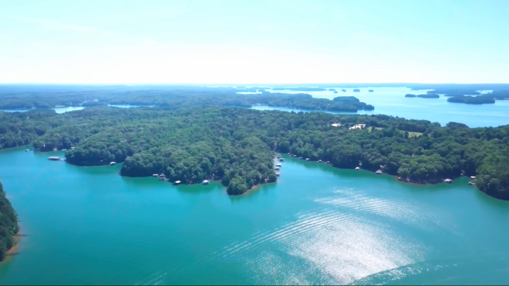
Islands in Lake Lanier
Lake Lanier is dotted with numerous islands that were formed after the construction of Buford Dam in the 1950s. These islands are not natural formations in the traditional sense but are the tops of hills that remained above water when the Chattahoochee and Chestatee river valleys were flooded to create the reservoir. Today, they add to the lake’s scenic character and recreational appeal.
When Lake Lanier was created by the U.S. Army Corps of Engineers, not all elevated terrain was cleared before flooding began. As water levels rose, hilltops became isolated, forming islands scattered across the lake. This geological origin explains why many islands are steep, wooded, and irregular in shape.
The most prominent and well-known island area is Lanier Islands, a developed 1,500-acre resort complex located near Buford, Georgia. It is a major tourist destination and features Margaritaville at Lanier Islands, which includes a water park and sandy beaches, along with hotels such as Legacy Lodge, golf courses, and campgrounds. Unlike most other islands on the lake, Lanier Islands is fully developed and designed for long-term visitor stays.
Beyond the resort area, Lake Lanier contains many smaller public and uninhabited islands, most of which are unnamed or locally named. These islands are managed by the U.S. Army Corps of Engineers (USACE) and are primarily used for day recreation, such as picnicking, swimming, and fishing. Overnight camping is prohibited on most islands, in line with USACE regulations.
Many of Lake Lanier’s islands are accessible only by boat, with access supported by 10 marinas located around the lake. Visitors are allowed to use public islands during the day, but must follow strict rules, especially regarding environmental protection and camping restrictions. The surrounding lake area includes over 40 parks and campgrounds, providing ample recreational opportunities without the need to stay overnight on the islands themselves.
The islands of Lake Lanier enhance the lake’s popularity for boating, fishing, and swimming, offering quiet rest stops and scenic views throughout the reservoir. Together, developed and undeveloped islands reflect both the engineered history of Lake Lanier and its continued role as one of Georgia’s most visited recreational lakes.
Wildlife in Lake Lanier
Lake Lanier supports a rich and diverse ecosystem shaped by its large reservoir, surrounding forests, and connected river systems. The combination of open water, wooded shoreline, and nearby wetlands creates ideal habitats for a wide range of mammals, birds, fish, and amphibians, making the lake an important refuge for wildlife as well as a popular destination for nature lovers and anglers.
Animals in Lake Lanier
| Wildlife Category | Species & Details |
|---|---|
| Mammals | White-tailed deer, red foxes, bobcats, raccoons, eastern cottontail rabbits, coyotes |
| Birds | Over 240 species including bald eagles, ospreys, herons, great blue herons, kingfishers, and various duck species |
| Fish | Striped bass, largemouth bass, spotted bass, black crappie, bluegill, catfish; trout found in the Chattahoochee River below Buford Dam |
| Amphibians & Reptiles | Various turtles, snakes, and frogs along the shoreline |
Fish Found in Lake Lanier
The lake is widely recognized as a premier fishing destination in Georgia. Popular fish species include striped bass, largemouth bass, spotted bass, black crappie, bluegill, and catfish. In addition to the lake itself, the Chattahoochee River below Buford Dam is well known for trout fishing, adding to the region’s angling diversity and ecological value.
Biggest Fish in Lake Lanier
The biggest fish commonly found in Lake Lanier is the striped bass. Striped bass are the lake’s top predators and are well known for their large size, strength, and popularity among anglers.
In Lake Lanier, striped bass can grow over 40 pounds and reach lengths of more than 4 feet under ideal conditions. The lake’s deep, cool waters and abundant forage make it one of Georgia’s best environments for producing large striped bass.
While other large fish such as catfish also live in the lake, striped bass are widely recognized as the largest and most sought-after fish species in Lake Lanier, especially for sport fishing.
Aquatic Plants in Lake Lanier
| Category | Aquatic Plants & Details |
|---|---|
| Submerged Plants | Water lilies, coontail, milfoil; common in shallow, sunlit areas and provide fish habitat |
| Invasive / Nuisance Species | Eurasian watermilfoil (forms thick mats), curly pondweed (identified threat) |
| Algae | Blue-green algae (cyanobacteria), especially in warm weather and coves; can produce toxins like microcystin |
| Other Vegetation | Chara, a complex macro-algae that resembles a vascular plant |
Recreational Activities
Lake Lanier is a year-round recreational destination known for its wide range of water-based and land-based activities. With expansive open water, scenic shorelines, and well-developed parks and resorts, the lake attracts visitors seeking adventure, relaxation, and family-friendly entertainment throughout all seasons.
| Category | Activities & Attractions |
|---|---|
| Boating & Sailing | Pontoon boats, jet skis, ski boats available at multiple marinas |
| Fishing | Striped bass, spotted bass, trout; world-class fishing destination |
| Swimming & Beaches | Buford Dam Park, Lake Lanier Olympic Park, Don Carter State Park |
| Water Park | Margaritaville at Lanier Islands with water slides and beach |
| Watersports | Wakeboarding, waterskiing, tubing |
| Kayaking & Paddleboarding | Popular across calm sections of the lake |
| Hiking & Trails | Bald Ridge Creek and other park trails |
| Golf | Legacy Golf Course, Chestatee Golf Club |
| Camping | Over a dozen campgrounds around the lake |
| Seasonal Events | Lake Lanier Wine Festival, 4th of July events, Snow Island |
| Key Locations | Lanier Islands, Lake Lanier Olympic Park, Don Carter State Park |
| Park Access | USACE day-use parks; small fees and annual passes available |
Water Activities
Lake Lanier is especially famous for its boating and sailing opportunities. With multiple marinas around the lake, visitors can rent pontoon boats, jet skis, and ski boats, making it easy to explore the water even without owning a vessel. The lake’s size and layout also make it ideal for wakeboarding, waterskiing, and tubing, particularly in wider, open sections.
Fishing is another major draw, as Lake Lanier is considered a premier fishing destination in Georgia. Anglers target striped bass and spotted bass, along with many other species, making the lake popular for both recreational and sport fishing. Swimming and beach activities are common during warmer months, with well-known spots including Buford Dam Park, Lake Lanier Olympic Park, and Don Carter State Park.
One of the lake’s standout attractions is Margaritaville at Lanier Islands, which features a large water park with slides, sandy beaches, and resort-style amenities. This area is especially popular with families and summer visitors looking for a resort-style experience on the lake.
Land-Based and Seasonal Activities
Beyond the water, Lake Lanier offers numerous hiking and nature trails, including scenic routes at Bald Ridge Creek and other park areas. Golf enthusiasts can enjoy lakeside views at Legacy Golf Course and Chestatee Golf Club, both known for their scenic settings.
Camping is another popular activity, with over a dozen campgrounds surrounding the lake. These range from developed campgrounds to more nature-focused sites, allowing visitors to stay close to the water and trails. Throughout the year, the lake also hosts seasonal events, including the Lake Lanier Wine Festival, Fourth of July celebrations, and Snow Island, a winter attraction at Lanier Islands.
Key Recreational Locations
Several well-known locations enhance the recreational appeal of Lake Lanier. Lanier Islands is recognized for its resorts, spas, golf course, and water park. Lake Lanier Olympic Park holds historical significance as the venue for rowing and paddling events during the 1996 Summer Olympics and continues to host sporting and community events. Don Carter State Park offers a mix of hiking, camping, and one of the lake’s most popular sandy beaches.
Importance of Lake Lanier
Lake Lanier is one of the most important freshwater lakes in northern Georgia, primarily because it supplies drinking water to millions of people in the Atlanta metropolitan area. The lake is formed by the Buford Dam on the Chattahoochee River and serves as a crucial reservoir for the region’s growing population.
The lake also plays a key role in flood control and water management. By regulating water flow from the Chattahoochee River, Lake Lanier helps prevent downstream flooding and ensures a steady supply of water for communities, agriculture, and ecosystems throughout Georgia and neighboring states.
Another major importance of Lake Lanier lies in energy production. Water released from Buford Dam is used to generate hydroelectric power, contributing clean, renewable energy to the regional power grid.
Lake Lanier is a major economic driver for the surrounding area. Tourism related to boating, fishing, resorts, marinas, parks, and seasonal events supports local businesses and creates thousands of jobs, making the lake a backbone of the regional economy.
Ecologically, the lake supports a rich and diverse ecosystem. It provides habitat for numerous fish species, migratory birds, mammals, and aquatic plants, helping maintain biodiversity and environmental balance in north Georgia.
Famous Ships Sunk in Lake Lanier
Lake Lanier is often surrounded by myths and rumors about sunken ships and hidden wrecks. In reality, the lake does not contain historic naval vessels or large maritime ships. Instead, what lies beneath its waters reflects the valley’s past and the circumstances under which the lake was created in the 1950s.
When the Buford Dam was completed and the Chattahoochee River valley was flooded, entire communities were submerged. Roads, bridges, racetracks, cemeteries, vehicles, and small watercraft were left behind, creating the underwater landscape that still exists today. Many of the so-called “sunken ships” in Lake Lanier are actually abandoned houseboats, docks, and personal vessels rather than traditional ships.
| Name / Nickname | Type | Era | Location in Lake Lanier | Key Details |
|---|---|---|---|---|
| Museum Houseboat | Abandoned houseboat | Mid–late 20th century | Cove area | Long-submerged houseboat removed in 2017 due to safety concerns |
| “The Titanic” | Abandoned boat/dock | Unknown | Various coves | Nickname given to one of about 20 sunken or abandoned boats and docks |
| Lady of the Lake Car | 1950s Ford sedan | 1950s | Near a bridge | Discovered in 1990 with human remains from a 1958 fatal accident |
| Submerged Boats & Docks | Small personal watercraft | 1950s onward | Throughout the lake | Numerous abandoned or sunken recreational boats |
| Submerged Infrastructure | Roads, racetrack, cemeteries | Pre-1956 | Across flooded valley | Includes old roads, Gainesville Speedway, and cemeteries submerged during lake creation |
The “Museum Houseboat”
One of the most well-known submerged vessels was an abandoned houseboat often referred to as the “Museum Houseboat.” It sat partially submerged in a cove for years and became a point of curiosity for boaters. In 2017, authorities removed the structure due to safety concerns, ending its long presence in the lake.
“The Titanic” of Lake Lanier
“The Titanic” is not an actual ship but a nickname given to one of roughly 20 abandoned boats and docks that have sunk or been left underwater over the decades. These derelict structures contribute to Lake Lanier’s reputation as a lake filled with hidden hazards, especially in shallow or poorly marked areas.
The Lady of the Lake Car
The most tragic and well-documented wreck in Lake Lanier is not a boat at all. In 1990, divers discovered a submerged 1950s Ford sedan near a bridge. Inside were the remains of a woman who had been missing since 1958. The discovery confirmed a fatal accident that had gone unsolved for more than three decades and became one of the lake’s most haunting stories.
Submerged Infrastructure Beneath the Lake
Beyond vehicles and boats, Lake Lanier conceals remnants of pre-flood communities. Divers have identified underwater ruins such as old roads, bridges, cemeteries, and even the former Gainesville Speedway. These submerged structures are a direct result of the rapid flooding that created the reservoir and are often mistaken for mysterious wrecks.
Scary Facts About Lake Lanier
| Scary Fact | Details |
|---|---|
| Submerged Towns | Entire communities, including homes, churches, roads, and businesses, were flooded when the lake was created in the 1950s |
| Sunken Cemeteries | Many graves were relocated, but some are believed to remain underwater, contributing to eerie legends |
| Oscarville Tragedy | The lake covers land from Oscarville, a Black community violently displaced in 1912 after racial attacks |
| Underwater Debris | Trees, buildings, fences, vehicles, and docks were not fully cleared before flooding, creating dangerous underwater hazards |
| High Drowning Rate | Lake Lanier is linked to hundreds of deaths over the decades, making it one of the deadliest lakes in the U.S. |
| “Lady of the Lake” Legend | A ghost story tied to a 1958 bridge accident involving two women and a submerged car |
| Poor Visibility | Murky water limits visibility for swimmers and divers, increasing accident risks |
| Sudden Drop-offs | The lake has steep underwater slopes and unexpected depth changes |
| Strong Currents | Water releases from Buford Dam can create powerful and unpredictable currents |
| Cold Water Shock | Even in summer, deeper water can be cold enough to cause sudden muscle shock |
Quick Facts About Lake Lanier
| Fact | Details |
|---|---|
| Official Name | Lake Sidney Lanier |
| Common Name | Lake Lanier |
| Location | Northeast Georgia, United States |
| Region | Foothills of the Blue Ridge Mountains |
| Nearest Major City | Approximately 50 miles northeast of Atlanta |
| Type | Man-made freshwater reservoir |
| Created By | U.S. Army Corps of Engineers |
| Construction Period | 1950–1956 |
| Year Filled | 1956–1958 |
| River Basin | Chattahoochee River Basin |
| Primary Inflow Rivers | Chattahoochee River, Chestatee River |
| Outflow | Chattahoochee River (via Buford Dam) |
| Surface Area | Around 38,000–39,000 acres |
| Shoreline Length | Approximately 692 miles |
| Maximum Length | About 26–27 miles |
| Maximum Width | Up to 2 miles in wider sections |
| Average Depth | Around 60 feet |
| Maximum Depth | About 160 feet near Buford Dam |
| Water Volume | Roughly 1.05 million acre-feet |
| Full Pool Elevation | 1,071 feet above mean sea level |
| Counties Covered | Hall, Forsyth, Dawson, Gwinnett, Lumpkin |
| Primary Purposes | Water supply, flood control, hydroelectric power |
| Water Supply Role | Major drinking-water source for Metro Atlanta |
| Managing Authority | U.S. Army Corps of Engineers |
| Major Attraction | Lanier Islands resort complex |
| Recreation Activities | Boating, fishing, swimming, kayaking, camping |
| Fish Species | Bass, striped bass, crappie, catfish, trout |
| Bird Species | Bald eagles, ospreys, herons, waterfowl |
| Annual Visitors | Over 10 million |
| Historic Note | Built over submerged towns, roads, and cemeteries |
| Famous Legend | “Lady of the Lake” ghost story |
Frequently Asked Questions About Lake Lanier
Q. Where is Lake Lanier?
A. Lake Lanier is located in northern Georgia, northeast of Atlanta.
Q. What town is under Lake Lanier?
A. The lake was created by flooding the former town of Oscarville, which now lies beneath the water.
Q. How big is Lake Lanier?/How many acres is Lake Lanier?
A. Lake Lanier covers about 38,000 acres, making it one of the largest lakes in Georgia.
Q. How deep is Lake Lanier?
A. Lake Lanier has a maximum depth of around 160 feet.
Q. How low is Lake Lanier?
A. Lake Lanier’s water level fluctuates seasonally, rising and falling based on rainfall and water management.
Q. What is under Lake Lanier?
A. Under Lake Lanier are submerged forests, roads, building foundations, and the former town of Oscarville, which were flooded when the lake was created in the 1950s.
Q. What fish are in Lake Lanier?
A. Lake Lanier is home to largemouth bass, spotted bass, striped bass, crappie, catfish, walleye, bream, and trout.
Q. Why is Lake Lanier considered cursed?
A. Lake Lanier is often called “cursed” due to a high number of drownings, boating accidents, and submerged hazards, combined with local legends linked to the flooded town of Oscarville, though there is no factual evidence of a curse.
Q. What is Lake Lanier known for?
A. Lake Lanier is known for boating, fishing, water sports, lakeside resorts, and supplying water to the Atlanta metro area.