Lake Erie is one of the five Great Lakes of North America and the fourth largest by surface area, playing a critical role in the geography, economy, and history of the United States. Lake Erie is the southernmost and warmest of the Great Lakes, making it a vital freshwater resource for millions of Americans. Its shallow depth, extensive shoreline, and connection to major waterways like the Detroit River and Niagara River have made Lake Erie central to U.S. shipping, industry, fishing, and recreation for centuries.
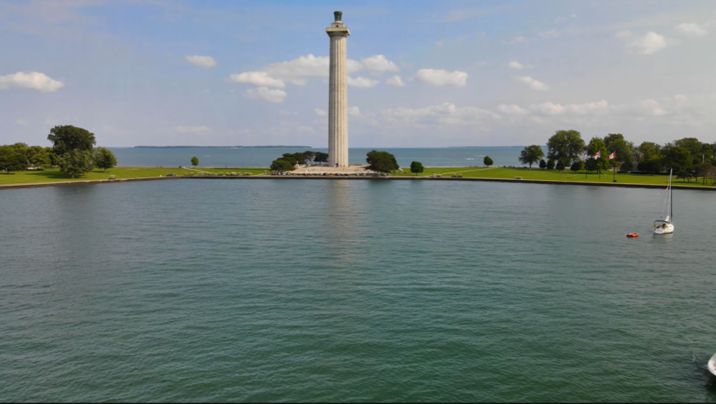
Table of Contents
Location of Lake Erie: Country, States, Cities
Lake Erie is located in two countries:the United States andCanada. It forms part of the international border between the two nations and is one of the five Great Lakes of North America (Superior, Michigan, Huron, and Ontario).
On the U.S. side, Lake Erie borders the states of Ohio, Pennsylvania, New York, Michigan, and Indiana, while the northern shoreline lies in the Canadian province of Ontario. This cross-border location makes Lake Erie an important freshwater resource for both countries, supporting transportation, trade, fisheries, and drinking water for millions of people—especially in the eastern and midwestern United States.
Countries Bordering Lake Erie
| Country | Lake Erie Shoreline |
|---|---|
| United States | Southern and western shores |
| Canada | Northern shore |
U.S. States Bordering Lake Erie
| U.S. State | Shoreline Location on Lake Erie |
|---|---|
| Ohio | Central and southern shoreline |
| Pennsylvania | Northeastern shoreline |
| New York | Eastern shoreline |
| Michigan | Northwestern shoreline |
| Indiana | Southwestern shoreline (short stretch) |
Canadian Province Bordering Lake Erie
| Province | Shoreline Location on Lake Erie |
|---|---|
| Ontario | Northern shoreline |
Major Cities on Lake Erie
The major cities on Lake Erie are located along its southern and northern shores in the United States and Canada, where the lake has long supported shipping, industry, agriculture, and tourism. These cities developed around natural harbors and ports, making Lake Erie a vital link in Great Lakes trade, transportation, and regional economic growth on both sides of the border.
Major Cities and Towns on Lake Erie in the United States
| Order (West → East) | City | State | Role / Importance |
|---|---|---|---|
| 1 | Monroe | Michigan | Industrial city and port near the western edge of Lake Erie |
| 2 | Toledo | Ohio | Major port city and key shipping hub in western Lake Erie |
| 3 | Sandusky | Ohio | Tourism center and ferry gateway to the Lake Erie Islands |
| 4 | Lorain | Ohio | Historic steel and shipping city with an active harbor |
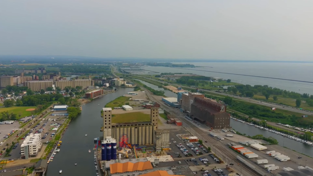
| 5 | Cleveland | Ohio | Largest U.S. city on Lake Erie; major industrial, port, and cultural center |
| 6 | Mentor | Ohio | Suburban city along the central Lake Erie shoreline |
| 7 | Ashtabula | Ohio | Important harbor city with a strong maritime history |
| 8 | Conneaut | Ohio | Northeastern Ohio port city near the Pennsylvania border |
| 9 | Erie | Pennsylvania | Pennsylvania’s only Lake Erie port; home to Presque Isle State Park |
| 10 | Dunkirk | New York | Industrial and port city on the eastern Lake Erie shoreline |
| 11 | Lackawanna | New York | Steel-industry city south of Buffalo along Lake Erie |
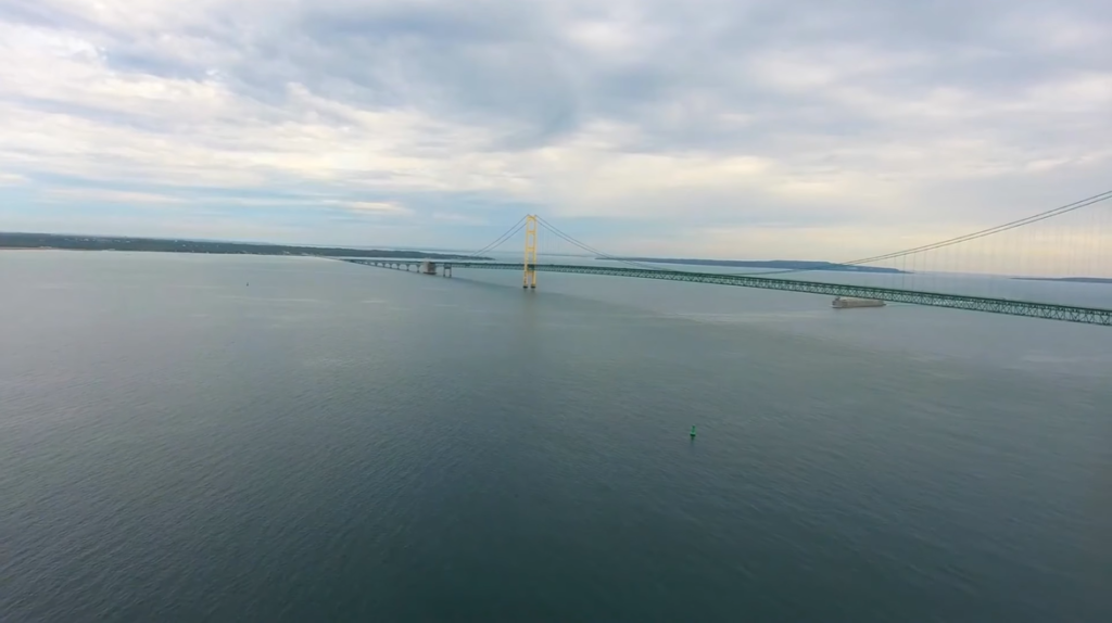
| 12 | Buffalo | New York | Eastern gateway of Lake Erie; connects to the Niagara River and Erie Canal |
Major Cities and Towns on Lake Erie in Canada
| Order (West → East) | City / Town | Province | Key Role / Significance |
|---|---|---|---|
| 1 | Amherstburg | Ontario | Historic town near the mouth of the Detroit River; tourism and heritage |
| 2 | Leamington | Ontario | Agricultural center and gateway to Point Pelee National Park |
| 3 | Kingsville | Ontario | Farming, wineries, and ferry access to Pelee Island |
| 4 | Pelee Island | Ontario | Southernmost inhabited point in Canada; tourism and wine production |
| 5 | Port Stanley | Ontario | Popular beach town and historic harbor |
| 6 | Port Dover | Ontario | Fishing town known for sandy beaches and summer tourism |
| 7 | Port Colborne | Ontario | Major inland port city on the Welland Canal connecting Lake Erie to Lake Ontario |
Size of Lake Erie: Surface Area, Volume, Length, Width, Shoreline, Depth
Lake Erie is the southernmost, shallowest, and smallest by volume of the five North American Great Lakes. Because of its relatively shallow depth, the lake warms rapidly, supports high biological productivity, and is more sensitive to weather changes and environmental impacts than the other Great Lakes.
| Feature | Measurement |
|---|---|
| Surface Area | 9,910 square miles (25,667 km²) |
| Volume | 116 cubic miles (483 km³) |
| Length | 241 miles (388 km) |
| Width (Maximum) | 57 miles (92 km) |
| Shoreline Length | 871 miles (1,402 km), including islands |
| Average Depth | 62 feet (19 meters) |
| Maximum Depth | 210 feet (64 meters) |
Surface Area of Lake Erie
Lake Erie covers a surface area of about 9,910 square miles, making it the fourth largest Great Lake by surface area. Despite being the smallest by volume, its broad, shallow expanse allows sunlight to penetrate more easily, which contributes to the lake’s high biological productivity and supports one of the most active freshwater fisheries in the United States.
Volume of Lake Erie
Lake Erie holds approximately 116 cubic miles of water, making it the smallest Great Lake by volume. Its low water volume means the lake responds quickly to environmental changes, including temperature shifts and nutrient runoff, which can intensify problems like algal blooms compared to deeper Great Lakes.
Maximum Length of Lake Erie
The maximum length of Lake Erie is about 241 miles, stretching from Toledo, Ohio, in the west to Buffalo, New York, in the east. This long east–west orientation plays a major role in wave formation and storm intensity, especially when strong winds travel the full length of the lake.
Maximum Width of Lake Erie
At its widest point, Lake Erie spans roughly 57 miles. This width allows large wind-driven waves to develop quickly, particularly in the central and eastern portions of the lake, making weather conditions potentially hazardous for boaters and commercial vessels.
Shoreline Length of Lake Erie
Lake Erie has a total shoreline length of approximately 871 miles, including its many islands and bays. This extensive shoreline supports major U.S. cities, ports, beaches, wetlands, and state parks, making it one of the most heavily populated and economically important Great Lakes shorelines.
Depth of Lake Erie
Lake Erie is the shallowest of the Great Lakes, with an average depth of about 62 feet and a maximum depth of roughly 210 feet in the eastern basin. Its shallow depth causes the lake to warm faster in summer and freeze more easily in winter, influencing storm behavior, ice formation, and overall lake ecology.
Formation and History of Lake Erie
Formation and Geological History of Lake Erie
Lake Erie was formed approximately 12,600 to 20,000 years ago near the end of the last Ice Age, when the massive Laurentide Ice Sheet carved a broad, shallow basin across the Great Lakes region. Over repeated glacial advances during the past one million years, moving ice gouged bedrock and reshaped the landscape. As the climate warmed, glaciers retreated and meltwater filled the basin, giving rise to Lake Erie. By about 10,000 years ago, the lake had largely taken its modern form, initially draining southwest toward the Mississippi River system before settling into its present outlet through the Niagara River. Its shallow average depth of 62 feet made Lake Erie the smallest Great Lake by volume and the most biologically productive.
Indigenous and Early Human History
Long before European exploration, Lake Erie was surrounded by Indigenous peoples who relied on its waters for food, transportation, and trade. The lake derives its name from the Eriez tribe, who inhabited the southern shoreline. Lake Erie was the last of the Great Lakes to be discovered by Europeans, but its location quickly made it strategically important for movement, commerce, and military control in early North American history.
Industrial Development and Environmental Decline
During the 19th and early 20th centuries, major U.S. cities such as Buffalo, Cleveland, and Toledo grew rapidly along Lake Erie’s shoreline. The lake became a vital route for shipping raw materials and manufactured goods, fueling industrial expansion. However, decades of industrial waste, agricultural runoff, and untreated sewage severely polluted the lake. By the 1960s and 1970s, Lake Erie experienced widespread oxygen depletion and massive algal blooms, leading it to be widely described as a “dead lake.”
Environmental Recovery and Modern Importance
Beginning in the 1970s, strong environmental regulations and binational cleanup efforts led to a dramatic improvement in water quality. Fish populations rebounded, wetlands were restored, and Lake Erie regained its role as one of the most productive freshwater ecosystems in North America. Today, Lake Erie provides drinking water, supports commercial and recreational fishing, and serves as a critical habitat for migratory birds, while continuing to face challenges such as nutrient pollution and habitat loss across four U.S. states and Ontario.
Major Rivers Feeding Lake Erie
Lake Erie is fed by a network of major rivers and tributaries from both the United States and Canada, with the Detroit River providing the vast majority of its water from the upper Great Lakes. In addition to this primary inflow, numerous U.S. and Canadian rivers drain surrounding agricultural and urban regions into the lake, strongly influencing its water levels, nutrient balance, and ecological health.
Major U.S. Rivers and Tributaries Feeding Lake Erie
| River / Tributary | State(s) | Importance |
|---|---|---|
| Detroit River | Michigan (shared waterway) | Primary inflow to Lake Erie; carries water from Lake St. Clair and the upper Great Lakes |
| Maumee River | Ohio | Largest tributary to any Great Lake by watershed size; drains about 8,316 square miles |
| Sandusky River | Ohio | Major Ohio river flowing into Sandusky Bay and Lake Erie |
| Cuyahoga River | Ohio | Flows through Cleveland; historically important to industry and shipping |
| Grand River | Ohio | Significant river in Northeast Ohio feeding the central Lake Erie basin |
| Conneaut Creek | Ohio / Pennsylvania | Eastern basin tributary contributing freshwater and sediments |
| Ottawa River | Ohio | Smaller tributary flowing into western Lake Erie near Toledo |
| Swan Creek | Ohio | Localized tributary contributing to the western basin |
Major Canadian Rivers and Inflow Sources Feeding Lake Erie
| River / Inflow Source | Province | Importance |
|---|---|---|
| Detroit River | Ontario (shared waterway) | Primary inflow to Lake Erie, supplying about 95% of the lake’s total water from the upper Great Lakes |
| Lake St. Clair | Ontario (shared lake) | Acts as the connecting basin between the St. Clair River and the Detroit River before water enters Lake Erie |
| Grand River | Ontario | Largest tributary within the Canadian Lake Erie watershed; drains a large agricultural region |
| Thames River | Ontario | Major southwestern Ontario river flowing into Lake St. Clair and onward to Lake Erie via the Detroit River |
| Sydenham River | Ontario | Important tributary contributing to the Lake St. Clair–Detroit River system |
| Smaller Ontario Rivers | Ontario | Numerous short rivers draining clay-rich soils, contributing nutrients and sediments |
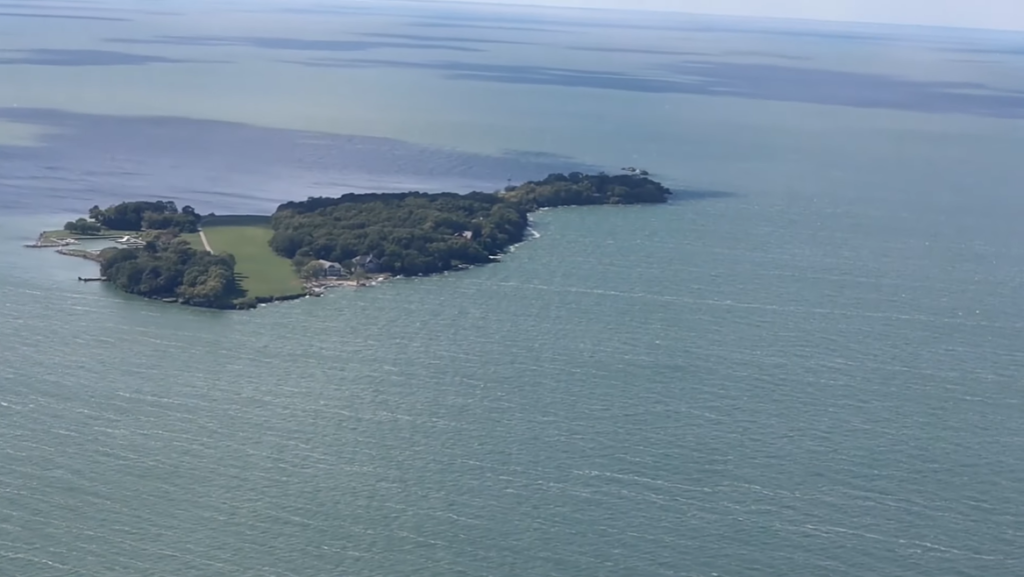
Islands in Lake Erie
Lake Erie contains more than 30 islands, most of which are clustered in the western basin, where the lake is shallowest. The majority of these islands belong to Ohio (USA), while the largest island—Pelee Island—lies in Ontario, Canada. Known for their limestone geology, ferry access, wineries, wildlife areas, and summer tourism, the Lake Erie islands are among the most popular destinations on the Great Lakes.
| Island | Country / State | Notability |
|---|---|---|
| Pelee Island | Canada (Ontario) | Largest island in Lake Erie (10,330 acres); wineries; southernmost inhabited point in Canada |
| Kelleys Island | USA (Ohio) | Ohio’s largest island; famous for glacial grooves and natural landscapes |
| South Bass Island | USA (Ohio) | Home to Put-in-Bay and Perry’s Victory & International Peace Memorial |
| Middle Bass Island | USA (Ohio) | Known for marinas, historic wineries, and quieter tourism |
| North Bass Island | USA (Ohio) | Mostly residential; vineyards and undeveloped natural areas |
| Johnson’s Island | USA (Ohio) | Located in Sandusky Bay; site of a historic Civil War POW camp |
| West Sister Island | USA (Ohio) | National Wildlife Refuge and major nesting site for wading birds |
Temperature of Lake Erie
Lake Erie has the warmest average water temperatures of all the Great Lakes because it is the shallowest. During summer, surface water temperatures typically range from 70°F to 75°F (21°C to 24°C), with the western basin often exceeding 80°F (27°C) during heat waves. This rapid warming supports high biological productivity but also increases the risk of harmful algal blooms, especially near Ohio’s shoreline.
In winter, Lake Erie cools quickly and is the most likely Great Lake to freeze. Surface temperatures drop to near 32°F (0°C), and in colder winters, large portions—sometimes nearly the entire lake—can be covered by ice. This seasonal freezing plays a role in wave reduction, shoreline protection, and ecosystem balance.
Seasonal Temperature Pattern of Lake Erie
| Season | Typical Surface Water Temperature | Key Characteristics |
|---|---|---|
| Winter (Dec–Feb) | ~32–36°F (0–2°C) | Coldest season; Lake Erie is the most likely Great Lake to partially or fully freeze, especially in the western basin |
| Spring (Mar–May) | ~36–55°F (2–13°C) | Slow warming due to cold winter water; temperature differences can create fog and unstable weather |
| Summer (Jun–Aug) | ~70–75°F (21–24°C), often 80°F+ in western basin | Warmest season; rapid warming supports recreation and fisheries but increases algal bloom risk |
| Fall (Sep–Nov) | ~65–45°F (18–7°C) | Rapid cooling; strong temperature contrasts fuel powerful storms and rough waves |
Month-Wise Surface Temperature of Lake Erie
| Month | Surface Water Temperature Range | Seasonal Notes |
|---|---|---|
| January | 32–36°F (0–2°C) | Coldest period; frequent ice cover, especially in the western basin |
| February | 32–40°F (0–4°C) | Ice cover often persists; slow warming begins late in the month |
| March | 37–43°F (3–6°C) | Ice starts breaking up; water remains very cold |
| April | 41–46°F (5–8°C) | Gradual warming, but temperatures stay low due to winter carryover |
| May | 42–45°F (6–7°C) | Noticeable warming begins; still cool for swimming |
| June | 53–55°F (12–13°C) | Early summer warming; strong temperature differences across the lake |
| July | 70–75°F (21–24°C) | Warmest month; western basin often warmer than central and eastern areas |
| August | 70–75°F (21–24°C) | Peak summer temperatures; occasional readings above 75°F |
| September | 60–68°F (16–20°C) | Cooling begins; water remains relatively warm |
| October | 50–59°F (10–15°C) | Rapid cooling; storm activity increases |
| November | 37–50°F (3–10°C) | Sharp temperature drop; early ice possible late in the month |
| December | 32–41°F (0–5°C) | Approaches freezing; ice formation resumes |
Wildlife in Lake Erie
Lake Erie supports a diverse and highly productive ecosystem, serving as critical habitat for fish, birds, mammals, and reptiles. Its shallow, warm waters make it one of the most biologically active of the Great Lakes. However, this productivity also makes Lake Erie especially vulnerable to pollution, harmful algal blooms, and invasive species, which continue to threaten native wildlife.
Animals in Lake Erie
| Category | Animals / Species | Notes |
|---|---|---|
| Mammals | Beaver, Muskrat, River Otter, Occasional Black Bear (nearshore areas) | Found mainly in coastal marshes, wetlands, and shoreline habitats |
| Birds | Bald Eagle, Waterfowl (ducks, geese), Shorebirds, Herons, Gulls | Lake Erie is a major stopover along North American migration routes |
| Fish | Walleye, Yellow Perch, Lake Whitefish, Muskellunge, Lake Trout | Support major U.S. commercial and recreational fisheries |
| Reptiles | Snapping Turtle, Painted Turtle | Common in shallow bays and wetlands |
| Snakes | Lake Erie Watersnake | Non-venomous species found mainly on Lake Erie islands |
| Folklore | “Bessie” (legend) | Legendary lake creature reported since the 1800s |
Fish Found in Lake Erie
| Fish Name | Category | Notes |
|---|---|---|
| Walleye | Popular Sport Fish | Most famous Lake Erie fish; supports one of the top walleye fisheries in the U.S. |
| Yellow Perch | Popular Sport Fish | Abundant and highly valued for commercial and recreational fishing |
| Lake Whitefish | Native Fish | Important commercial species, especially in deeper waters |
| Muskellunge | Native Fish | Large predatory fish found mainly in the western and central basins |
| Lake Trout | Native Fish | Present mainly in the deeper eastern basin; stocked and managed |
| Smallmouth Bass | Native Fish | Common near rocky shorelines and island areas |
| Largemouth Bass | Native Fish | Found in warm, shallow bays and wetlands |
| Lake Sturgeon | Large Native Fish | Largest Great Lakes fish; slow-growing and protected |
| Sea Lamprey | Invasive Fish | Parasitic species that feeds on native fish |
| White Perch | Invasive Fish | Competes with native species for food and habitat |
| Round Goby | Invasive Fish | Disrupts native fish populations and food chains |
Biggest Fish in Lake Erie
| Fish Name | Maximum Size | Weight | Notes |
|---|---|---|---|
| Lake Sturgeon | Up to 6–7 ft (1.8–2.1 m) | 100–300 lbs | Largest and heaviest fish in Lake Erie; protected species under restoration |
| Muskellunge | Up to 5 ft (1.5 m) | 55–70 lbs | Largest predatory sport fish in Lake Erie |
| Lake Trout | Up to 4 ft (1.2 m) | 40–50 lbs | Deep-water species mainly found in the eastern basin |
| Flathead Catfish | Up to 5 ft (1.5 m) | 60–100 lbs | Rare but present; one of the heaviest fish by weight |
| Northern Pike | Up to 4.5 ft (1.4 m) | 50–60 lbs | Powerful predator found in weedy bays and marshes |
Aquatic Plants in Lake Erie
| Plant Type | Common Aquatic Plants | Notes |
|---|---|---|
| Submerged Plants | Coontail, Slender Naiad, Bladderworts, Pondweeds (Potamogeton spp., Stuckenia pectinata) | Grow entirely underwater; provide fish habitat and help stabilize sediments |
| Floating-Leaf Plants | American Lotus, White Water-Lily, Watershield, Duckweed | Found mainly in shallow bays and wetlands; provide shade and reduce wave action |
| Emergent Plants | Pickerelweed, Arrowhead, Sweet Flag, Water Smartweed | Rooted in shallow water with stems above the surface; important for shoreline stability |
| Invasive Aquatic Plants | Water Hyacinth, Water Lettuce, Curly-Leaf Pondweed | Aggressive species that can overtake native plants and disrupt ecosystems |
Famous Ships Sunk in Lake Erie
Lake Erie is often called a “ship graveyard” due to its shallow depth, sudden storms, and heavy historical traffic. Thousands of vessels have been lost here, making it one of the most wreck-dense lakes in the world. Below table highlighting some of the most famous and historically significant shipwrecks in Lake Erie.
| Ship Name | Year Sunk | Vessel Type | Location (Near U.S.) | Cause of Sinking | Notability |
|---|---|---|---|---|---|
| Marquette & Bessemer No. 2 | 1909 | Railroad Car Ferry | Open Lake Erie | Blizzard storm | Legendary lost ship; never found, known as Lake Erie’s “Holy Grail” |
| G. P. Griffith | 1850 | Passenger Steamer | Near Willoughby, Ohio | Fire and sinking | One of the deadliest disasters on Lake Erie |
| Lake Serpent | 1829 | Schooner | Off Ohio coast | Unknown (likely storm) | One of the oldest known Lake Erie wrecks; discovered in 2018 |
| Sultan | 1864 | Wooden Brig | Northeast of Cleveland, Ohio | Severe storm | Carrying grinding stones; wreck lies in shallow water |
| Anthony Wayne | 1850 | Steamer | Near Vermilion, Ohio | Boiler explosion | Early industrial-era maritime disaster |
| Dean Richmond | 1893 | Freight Steamer | Near North East, Pennsylvania | Violent storm | Lost with all crew; discovered decades later |
| Prison Ship Success | 1946 | Historic Prison Ship | Cleveland Harbor | Arson | Former floating museum destroyed by fire |
Importance of Lake Erie
Lake Erie plays a crucial role in the environmental, economic, and social fabric of the United States, especially for the Great Lakes region. As the warmest, shallowest, and most biologically productive Great Lake, it supports millions of people, major industries, and one of North America’s most important freshwater ecosystems.
Importance of Lake Erie (U.S. Perspective)
| Category | Importance |
|---|---|
| Drinking Water | Provides drinking water to over 11 million people in the U.S., including residents of Ohio, Pennsylvania, Michigan, and New York |
| Fisheries | Supports one of the most valuable freshwater fisheries in the United States, especially for walleye and yellow perch |
| Economy | Drives billions of dollars annually through commercial shipping, fishing, tourism, and recreation |
| Agriculture | Supplies water for irrigation and supports fertile farmland across the Lake Erie basin |
| Biodiversity | Hosts the richest biodiversity of all the Great Lakes, including fish, wetlands, birds, and endangered species |
| Transportation | A key shipping corridor connecting Midwestern industries to the St. Lawrence Seaway and Atlantic Ocean |
| Tourism & Recreation | Popular for boating, beaches, islands, sport fishing, and waterfront cities like Cleveland, Toledo, and Erie |
| Climate Influence | Moderates local climate and contributes to lake-effect snow, benefiting regional agriculture |
| Research & Conservation | Central to U.S. efforts in water quality improvement, invasive species control, and climate research |
Scary Facts About Lake Erie
Lake Erie may look calm and inviting, but beneath its surface lies one of the most dangerous and unpredictable bodies of freshwater in North America. Its shallow depth, violent storms, and dark history have earned it a chilling reputation among sailors, scientists, and locals alike.
| Scary Fact | Explanation |
|---|---|
| Sudden, Violent Storms | Lake Erie experiences fast-forming storms that can generate large, crashing waves within minutes, leaving little time to react |
| Shallow but Deadly Waters | As the shallowest Great Lake, wind energy transfers directly to the surface, creating steep, dangerous waves rather than rolling swells |
| Thousands of Shipwrecks | Known as a “ship graveyard,” Lake Erie holds an estimated 2,000+ shipwrecks, many still undiscovered |
| Cold Shock Risk | Even in summer, deeper waters remain cold enough to cause instant cold shock, leading to rapid drowning |
| Rapid Weather Changes | Clear skies can quickly turn into fog, thunderstorms, or whiteout conditions, especially in fall and winter |
| Deadly Ice Conditions | Winter brings thick ice sheets, pressure ridges, and sudden ice break-ups, trapping ice fishermen and vehicles |
| Toxic Algal Blooms | Harmful cyanobacteria blooms can contaminate drinking water and pose serious health risks to humans and pets |
| Powerful, Unpredictable Currents | Storms and river inflows create strong currents near shorelines and river mouths |
| Eerily Preserved Shipwrecks | Cold, low-oxygen water keeps wrecks remarkably intact, with cargo and personal items still visible |
| Lake Erie Monster Legends | Folklore dating back to 1817 describes “Bessie,” the Lake Erie Monster, with repeated sightings reported |
Quick Facts About Lake Erie
| Category | Details |
|---|---|
| Location | United States & Canada |
| U.S. States Bordering | Ohio, Pennsylvania, New York, Michigan |
| Canadian Province | Ontario |
| Great Lakes Rank | 4th largest by surface area |
| Surface Area | 9,910 square miles (25,667 km²) |
| Volume | 116 cubic miles (483 km³) |
| Length | 241 miles (388 km) |
| Width | 57 miles (92 km) |
| Average Depth | 62 feet (19 meters) |
| Maximum Depth | 210 feet (64 meters) |
| Shoreline Length | 871 miles (1,402 km), including islands |
| Elevation | About 570 feet (174 meters) above sea level |
| Number of Islands | 30+ islands |
| Warmest Great Lake | Yes |
| Shallowest Great Lake | Yes |
| Primary Inflow | Detroit River |
| Primary Outflow | Niagara River |
| Water Retention Time | ~2.6 years (shortest of the Great Lakes) |
| Notable Fish | Walleye, Yellow Perch, Lake Sturgeon |
| Known For | Fishing, shipwrecks, storms, islands, algal blooms |
Frequently Asked Questions About Lake Erie
Q. Where is Lake Erie?/What state is Lake Erie in?/Is Lake Erie in Canada or USA?
A. Lake Erie lies on the border of the United States (Ohio, Pennsylvania, New York) and Canada (Ontario).
Q. How did Lake Erie get its name?
A. Lake Erie is named after the Erie Native American tribe, who historically lived along the lake’s southern shore.
Q. How big is Lake Erie?
A. Lake Erie is the fourth-largest Great Lake by surface area (9,910 square miles).
Q. How deep is Lake Erie?/How deep is Lake Erie in feet?
A. Lake Erie has an average depth of about 62 feet and a maximum depth of roughly 210 feet, making it the shallowest Great Lake by depth.
Q. How wide is Lake Erie?
A. Lake Erie is about 241 miles long and up to 57 miles wide.
Q. What is the temperature of Lake Erie?
A. Lake Erie’s surface temperature ranges from near 32°F in winter to about 70–75°F in summer.
Q. When does Lake Erie freeze?
A. Lake Erie can freeze in winter, usually from December to March, with the shallow western basin freezing most often.
Q. How many gallons of water are in Lake Erie?
A. Lake Erie has approximately 128 trillion gallons of water.
Q. What fish are in Lake Erie?
A. Lake Erie supports over 100 fish species, including Walleye, Yellow Perch, Smallmouth Bass, and Steelhead.
Q. Why is Lake Erie called a dead lake?
A. Lake Erie was called a “dead lake” in the 1960s–70s due to pollution and algal blooms, though cleanup efforts have since improved its health.
Q. What is Lake Erie known for?/Why is Lake Erie so famous?
A. Lake Erie is known for being the warmest and shallowest Great Lake, with great fishing, scenic islands, and major U.S. port cities.
Q. Why is Lake Erie so dangerous?
A. Lake Erie’s shallow depth can cause sudden, powerful storms and rough waves, making it dangerous for navigation.
Q. How big is Lake Erie in acres?
A. Lake Erie covers about 6.3 million acres.
Q. How deep is Lake Erie in Ohio?
A. Lake Erie has an average depth of about 62 feet.
Q. What city is Lake Erie in?
A. Lake Erie borders several cities, including Cleveland and Toledo in Ohio, Buffalo in New York, and Windsor in Ontario, Canada.